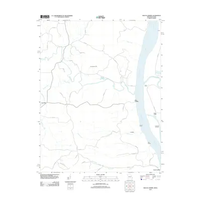
2012 Map of Neelys Landing
USGS Topo · Published 2012About this map
Mississippi River boat landings and small upland communities define this border region between Missouri and Illinois. At the southern edge of the map, the namesake Neelys Landing sits near the mouth of Neelys Creek, while other riverside points like Hines Landing, Wilson Landing, and Crawford Landing trace the historic reliance on the river for transport and trade. The convergence of the Big Muddy River with the Mississippi marks a significant hydrological junction near Union Point.
Find a feature on this map
45 named features on this map. Tap any name to fly to it.
Don’t see what you’re looking for? This feature index may not catch every label — zoom into the map to look around manually.
Map Details
Editions of this 2012 Neelys Landing Map
This is the sole edition of this map. No revisions or reprints were ever made.
Other maps of this area

1918 · Altenburg
USGS Topo · 1:62,500

1920 · Jonesboro
USGS Topo · 1:62,500

1922 · Cape Girardeau
USGS Topo · 1:62,500

1923 · Jonesboro
USGS Topo · 1:62,500

1924 · Cape Girardeau
USGS Topo · 1:62,500

1924 · Alto Pass
USGS Topo · 1:62,500

1925 · Altenburg
USGS Topo · 1:62,500

1947 · Jonesboro
USGS Topo · 1:62,500

1947 · Alto Pass
USGS Topo · 1:62,500

1947 · Crosstown
USGS Topo · 1:24,000