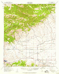
1943 Map of Neenach
USGS Topo · Published 1958About this map
The San Andreas Rift Zone cuts across the southwestern corner of this 1943 survey, where the rugged Liebre Mountains meet the vast floor of the Antelope Valley. This landscape is defined by the critical infrastructure of the Los Angeles Aqueduct, which runs southward past the Antelope Aqueduct Sta. The transition from the high ridges of El Tejon to the valley floor is dotted with established homesteads and lodges, including Sandberg Lodge and the La Liebre Ranch.
Find a feature on this map
58 named features on this map. Tap any name to fly to it.
Don’t see what you’re looking for? This feature index may not catch every label — zoom into the map to look around manually.
Map Details
Editions of this 1943 Neenach Map
3 editions found

Other maps of this area

1903 · Tejon
USGS Topo · 1:125,000

1914 · Caliente
USGS Topo · 1:125,000

1915 · Elizabeth Lake
USGS Topo · 1:125,000

1915 · Mojave
USGS Topo · 1:125,000

1917 · Elizabeth Lake
USGS Topo · 1:125,000

1931 · Tejon Hills
USGS Topo · 1:31,680

1932 · Fairmont
USGS Topo · 1:24,000

1932 · Neenach
USGS Topo · 1:24,000

1933 · Manzana
USGS Topo · 1:24,000

1933 · Quail
USGS Topo · 1:24,000