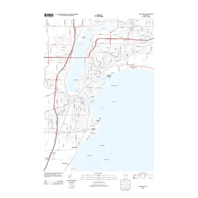
2013 Map of Neenah
USGS Topo · Published 2013About this map
The complex waterways of the Fox River system dominate this landscape, where the current splits into the Menasha Channel and Neenah Channel around the central Doty Island. The city layout reflects a dense integration of residential streets and industrial heritage, highlighted by the Menasha Water Works and the proximity to large basins like Little Lake Butte Des Morts. Along the northwestern shore of Lake Winnebago, numerous landmarks like Neenah Point and Davis Point punctuate the coast. To the south, the settlement of Snells and the With Wings and a Halo Airport show the outward expansion of the community toward the rural fringe. The map also detail shoreline features including Rainbow Beach and several underwater markers such as Lighthouse Reef and Mansur Reef, which are critical for navigating this portion of the lake.
Find a feature on this map
42 named features on this map. Tap any name to fly to it.
Don’t see what you’re looking for? This feature index may not catch every label — zoom into the map to look around manually.
Map Details
Editions of this 2013 Neenah Map
This is the sole edition of this map. No revisions or reprints were ever made.
Other maps of this area

1911 · Neenah
USGS Topo · 1:62,500

1955 · Neenah
USGS Topo · 1:62,500

1955 · Appleton
USGS Topo · 1:24,000

1955 · Appleton
USGS Topo · 1:62,500

1955 · Neenah
USGS Topo · 1:24,000

1955 · Green Bay
USGS Topo · 1:250,000

1956 · New London
USGS Topo · 1:48,000

1961 · Oshkosh
USGS Topo · 1:24,000

1961 · Oshkosh
USGS Topo · 1:62,500

1961 · Oshkosh NE
USGS Topo · 1:24,000