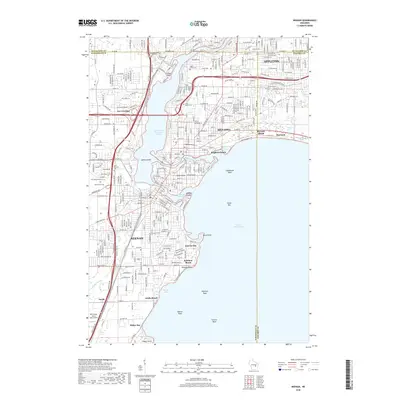
2018 Map of Neenah
USGS Topo · Published 2018About this map
Lake Winnebago and its western shores define the industrial and residential geography of the Fox River Valley on this 2018 survey. The twin cities of Neenah and Menasha sit at the mouth of the lake, separated by the Neenah Channel and Menasha Channel which flow around Doty Island. This area, deeply tied to the paper industry and river navigation, shows a dense network of suburban growth extending into Fox Crossing and south toward Snells. Genealogists will find numerous Catholic burial grounds well-documented, including Saint Mary's Cem, Saint Patrick's Cem, and Saint Margaret's Cem. The map detail extends to the complex shoreline features of the lake, such as Lighthouse Reef, Outer Bar, and Rainbow Beach, illustrating how the community interacts with the water across established landings like Payne Point and sheltered inlets like Sunrise Bay.
Find a feature on this map
58 named features on this map. Tap any name to fly to it.
Don’t see what you’re looking for? This feature index may not catch every label — zoom into the map to look around manually.
Map Details
Editions of this 2018 Neenah Map
This is the sole edition of this map. No revisions or reprints were ever made.
Other maps of this area

1911 · Neenah
USGS Topo · 1:62,500

1955 · Neenah
USGS Topo · 1:62,500

1955 · Appleton
USGS Topo · 1:24,000

1955 · Appleton
USGS Topo · 1:62,500

1955 · Neenah
USGS Topo · 1:24,000

1955 · Green Bay
USGS Topo · 1:250,000

1956 · New London
USGS Topo · 1:48,000

1961 · Oshkosh
USGS Topo · 1:24,000

1961 · Oshkosh
USGS Topo · 1:62,500

1961 · Oshkosh NE
USGS Topo · 1:24,000