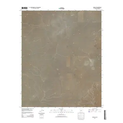
2013 Map of Negra SW
USGS Topo · Published 2013About this map
Torrance County’s high desert plains are defined by their vast topography and technical land divisions in this 2013 survey. The landscape is primarily organized by the Public Land Survey System, which establishes the boundaries for t5n r11e, t5n r12e, t4n r11e, t4n r12e, t3n r11e, and t3n r12e. This area of New Mexico is sparsely developed, with Co Road Co57 serving as the primary corridor through the northeastern portion of the quadrangle. The map captures the subtle drainage patterns and elevation changes of the Negra SW region, reflecting the rural character of the Southwest where ranching and open land predominate. It provides a precise record of the infrastructure and land management during the early 21st century.
Find a feature on this map
7 named features on this map. Tap any name to fly to it.
Don’t see what you’re looking for? This feature index may not catch every label — zoom into the map to look around manually.
Map Details
Editions of this 2013 Negra SW Map
This is the sole edition of this map. No revisions or reprints were ever made.
Other maps of this area

1954 · Fort Sumner
USGS Topo · 1:250,000

1958 · Fort Sumner
USGS Topo · 1:250,000

1978 · Negra SW
USGS Topo · 1:24,000

1978 · Pedernal
USGS Topo · 1:24,000

1978 · Negra SE
USGS Topo · 1:24,000

1978 · Negra
USGS Topo · 1:24,000

1978 · Lucy
USGS Topo · 1:24,000

1978 · Rattlesnake Hill
USGS Topo · 1:24,000

1980 · Corona
USGS Topo · 1:100,000

1981 · Progresso NE
USGS Topo · 1:24,000