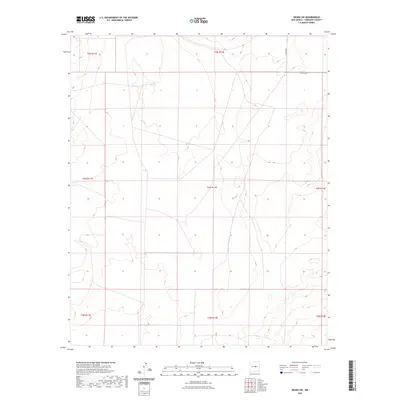
2023 Map of Negra SW
USGS Topo · Published 2023About this map
Torrance County’s high plains terrain is defined here by the systematic grid of the Public Land Survey System, spanning several townships including t4n r12e and t5n r12e. This area of New Mexico exhibits a sparse, open landscape where infrastructure is minimal, consisting primarily of remote thoroughfares such as Co Rd C038 and Co Rd C057. The topography is characterized by subtle drainage patterns and wide basins typical of the region's ranching country. The lack of concentrated settlements or named water bodies on this map underscores the isolation of this corner of the state, where the legal boundaries of the land survey remain the primary identifiers for property and navigation.
Find a feature on this map
10 named features on this map. Tap any name to fly to it.
Don’t see what you’re looking for? This feature index may not catch every label — zoom into the map to look around manually.
Map Details
Editions of this 2023 Negra SW Map
This is the sole edition of this map. No revisions or reprints were ever made.
Other maps of this area

1954 · Fort Sumner
USGS Topo · 1:250,000

1958 · Fort Sumner
USGS Topo · 1:250,000

1978 · Negra SW
USGS Topo · 1:24,000

1978 · Pedernal
USGS Topo · 1:24,000

1978 · Negra SE
USGS Topo · 1:24,000

1978 · Negra
USGS Topo · 1:24,000

1978 · Lucy
USGS Topo · 1:24,000

1978 · Rattlesnake Hill
USGS Topo · 1:24,000

1980 · Corona
USGS Topo · 1:100,000

1981 · Progresso NE
USGS Topo · 1:24,000