
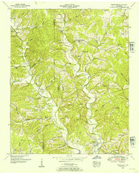
1936 Map of Negro Hollow
USGS Topo · Published 1936About this map
Forty-eight Creek and its many branches form the backbone of this Wayne County landscape, recorded during a 1936 field examination. The drainage patterns are intricate, with narrow hollows like Louse Hollow and Negro Hollow carving through the terrain. Evidence of a rural community structure is visible in the distribution of educational and religious sites, including Mt Hope Sch and Blowing Springs Sch. The road network is anchored by U S Highway No 64, which runs east-to-west alongside a prominent Power Transmission Line. Small family and community burial grounds, such as Walnut Grove Cem and Cole Cem, are scattered across the hillsides, often near small settlements like Simmons or the banks of the Green River. This Tennessee Valley Authority collaboration highlights a moment of infrastructure development, showing the intersection of new state highways and established rural landmarks.
Find a feature on this map
38 named features on this map. Tap any name to fly to it.
Don’t see what you’re looking for? This feature index may not catch every label — zoom into the map to look around manually.
Map Details
Editions of this 1936 Negro Hollow Map
This is the sole edition of this map. No revisions or reprints were ever made.
Other maps of this area

1905 · Waynesboro
USGS Topo · 1:125,000

1936 · Riverside
USGS Topo · 1:24,000

1936 · Westpoint
USGS Topo · 1:24,000

1936 · Collinwood
USGS Topo · 1:24,000

1936 · Leatherwood
USGS Topo · 1:24,000

1936 · Three Churches
USGS Topo · 1:24,000

1936 · Waynesboro
USGS Topo · 1:24,000

1936 · Topsy
USGS Topo · 1:24,000

1936 · Ovilla
USGS Topo · 1:24,000
1950 · Westpoint
USGS Topo · 1:24,000