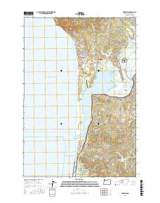
2017 Map of Nehalem
USGS Topo · Published 2017About this map
Neahkahnie Mtn anchors the northern coastline of this Tillamook County reach, where the Pacific Ocean meets a complex system of bays and spits. The Nehalem River winds past the established riverfront communities of Nehalem and Wheeler, eventually opening into the expansive Nehalem Bay. This geography is defined by the long protective arm of the Nehalem Spit, which shelters the bay from the open ocean and houses the Nehalem Bay State Airport.
Find a feature on this map
71 named features on this map. Tap any name to fly to it.
Don’t see what you’re looking for? This feature index may not catch every label — zoom into the map to look around manually.
Map Details
Editions of this 2017 Nehalem Map
This is the sole edition of this map. No revisions or reprints were ever made.
Other maps of this area

1937 · Nehalem
USGS Topo · 1:62,500

1940 · Cape Falcon
USGS Topo · 1:62,500

1943 · Nehalem
USGS Topo · 1:62,500

1948 · Vancouver
USGS Topo · 1:250,000

1950 · Vancouver
USGS Topo · 1:250,000

1950 · Vancouver
USGS Topo · 1:250,000

1955 · Nehalem
USGS Topo · 1:62,500
1955 · Cannon Beach
USGS Topo · 1:62,500

1958 · Vancouver
USGS Topo · 1:250,000

1964 · Vancouver
USGS Topo · 1:250,000