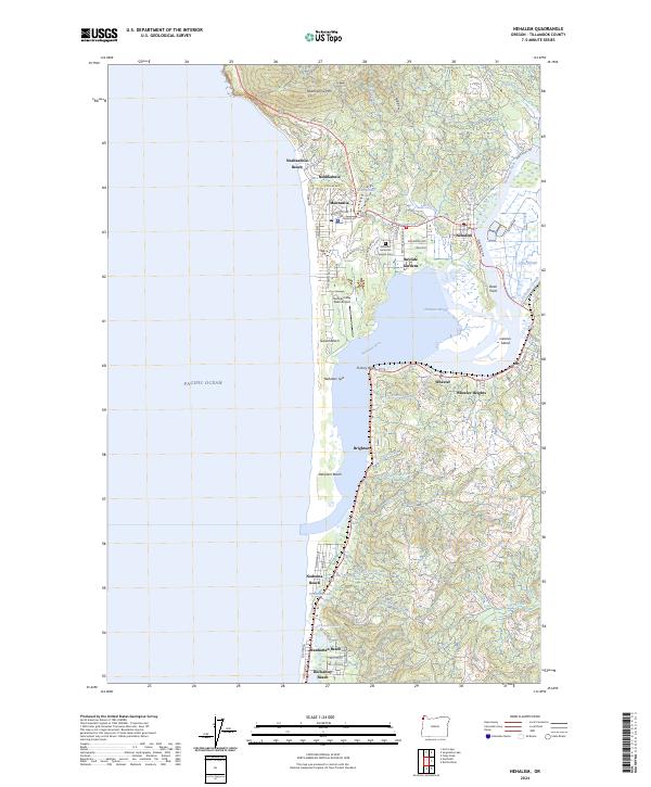
2024 Map of Nehalem
USGS Topo · Published 2024About this map
The northern Oregon coastline near Nehalem is defined by the dramatic meeting of the Pacific Ocean and the sprawling estuary formed by the Nehalem River. This modern survey details the complex geography of Nehalem Bay, where the narrow Nehalem Spit protects the inner waters from the sea. Along the shore, a string of coastal communities including Manzanita, Neahkahnie Beach, and Rockaway Beach follow the dunes and terraces of the coast, connected by the historical alignment of the Pacific Coast Highway.
Find a feature on this map
86 named features on this map. Tap any name to fly to it.
Don’t see what you’re looking for? This feature index may not catch every label — zoom into the map to look around manually.
Map Details
Editions of this 2024 Nehalem Map
This is the sole edition of this map. No revisions or reprints were ever made.
Other maps of this area

1937 · Nehalem
USGS Topo · 1:62,500

1940 · Cape Falcon
USGS Topo · 1:62,500

1943 · Nehalem
USGS Topo · 1:62,500

1948 · Vancouver
USGS Topo · 1:250,000

1950 · Vancouver
USGS Topo · 1:250,000

1950 · Vancouver
USGS Topo · 1:250,000

1955 · Nehalem
USGS Topo · 1:62,500
1955 · Cannon Beach
USGS Topo · 1:62,500

1958 · Vancouver
USGS Topo · 1:250,000

1964 · Vancouver
USGS Topo · 1:250,000