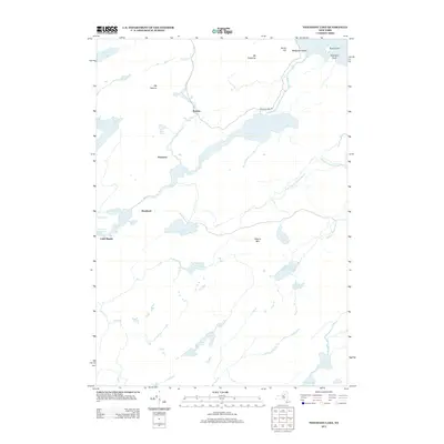
2013 Map of Nehasane Lake
USGS Topo · Published 2013About this map
Nehasane Lake and the winding course of the Beaver River anchor this 2013 snapshot of a landscape defined by its interconnected waterways and low peaks. The settlement of Brandreth and the remote stop at Keepawa reflect a history of limited access and private forest lands, where development is clustered along water-level routes like the Partlow Lake Rd. The map illustrates a transition from the structured shorelines of Stillwater Reservoir and Lake Lila to the untamed drainages of Shingle Shanty Brook and the South Branch. High points such as Mt Electra and Albany Mtn rise above a mosaic of smaller water bodies, including Terror Lake, Rose Pond, and Thayer Lake. This topography suggests a legacy of seasonal camps and careful forest management, with named features like Wigwam Point and Little Rapids indicating long-established local landmarks within the woods.
Find a feature on this map
32 named features on this map. Tap any name to fly to it.
Don’t see what you’re looking for? This feature index may not catch every label — zoom into the map to look around manually.
Map Details
Editions of this 2013 Nehasane Lake Map
This is the sole edition of this map. No revisions or reprints were ever made.
Other maps of this area

1903 · Big Moose
USGS Topo · 1:62,500

1903 · Raquette Lake
USGS Topo · 1:62,500

1907 · Tupper Lake
USGS Topo · 1:62,500

1919 · Cranberry Lake
USGS Topo · 1:62,500

1921 · Cranberry Lake
USGS Topo · 1:62,500

1931 · Cranberry Lake
USGS Topo · 1:62,500

1948 · Ogdensburg
USGS Topo · 1:250,000

1950 · Utica
USGS Topo · 1:250,000

1951 · Ogdensburg
USGS Topo · 1:250,000

1953 · Ogdensburg
USGS Topo · 1:250,000