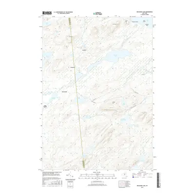
2016 Map of Nehasane Lake
USGS Topo · Published 2016About this map
Nehasane Lake and the winding Beaver River define this high-altitude landscape where the boundary between Hamilton and Herkimer counties cuts through dense Adirondack forests. Small clearings such as Partlow, Keepawa, and Brandreth suggest a quiet, localized history of seasonal habitation or forestry management along the water's edge. The hydrography is particularly complex, featuring a network of isolated water bodies like Shingle Shanty Pond, Terror Lake, and the sprawling Stillwater Reservoir to the west. Peaks like Mt Electra and Albany Mtn rise above the drainage basins of Shingle Shanty Brook and Alder Creek, illustrating the drainage patterns that feed into the larger reservoir systems of the region. Access to these remote reaches is limited to specialized routes such as Thayer Lake Rd and Shingle Shanty Rd, emphasizing the area's isolation from major development.
Find a feature on this map
33 named features on this map. Tap any name to fly to it.
Don’t see what you’re looking for? This feature index may not catch every label — zoom into the map to look around manually.
Map Details
Editions of this 2016 Nehasane Lake Map
This is the sole edition of this map. No revisions or reprints were ever made.
Other maps of this area

1903 · Big Moose
USGS Topo · 1:62,500

1903 · Raquette Lake
USGS Topo · 1:62,500

1907 · Tupper Lake
USGS Topo · 1:62,500

1919 · Cranberry Lake
USGS Topo · 1:62,500

1921 · Cranberry Lake
USGS Topo · 1:62,500

1931 · Cranberry Lake
USGS Topo · 1:62,500

1948 · Ogdensburg
USGS Topo · 1:250,000

1950 · Utica
USGS Topo · 1:250,000

1951 · Ogdensburg
USGS Topo · 1:250,000

1953 · Ogdensburg
USGS Topo · 1:250,000