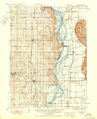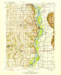
1935 Map of Nehawka
USGS Topo · Published 1954About this map
The Missouri River serves as the central artery and state boundary in this mid-1930s survey, illustrating a complex hydraulic landscape of islands and bars like Tobacco Island and Auldon Bar. To the west, the Nebraska bluffs are densely dotted with small rural institutions, including the Otterbein Ch and numerous family-named landmarks such as Youngs Cem and Eatons Cem. The settlement pattern reflects the importance of the rail corridors, with the Missouri Pacific and Chicago Burlington and Quincy lines supporting towns like Union and Murray.
Find a feature on this map
78 named features on this map. Tap any name to fly to it.
Don’t see what you’re looking for? This feature index may not catch every label — zoom into the map to look around manually.
Map Details
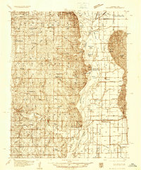
Editions of this 1935 Nehawka Map
2 editions found
Historical Maps of Plattsmouth Through Time
7 maps found