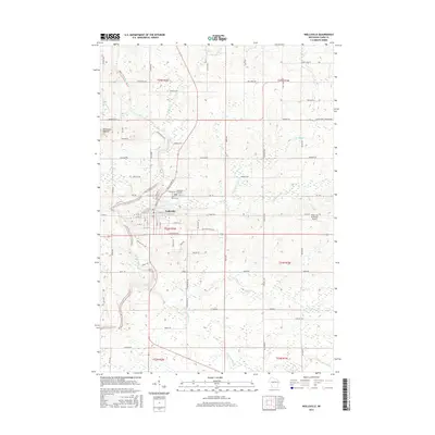
2015 Map of Neillsville
USGS Topo · Published 2015About this map
The city of Neillsville serves as the focal point of this Clark County landscape, situated at the confluence of the Black River and O'Neill Creek. This 2015 survey illustrates a well-defined urban grid surrounded by an extensive network of rural roads that follow the Public Land Survey System, such as Granton Rd, Maple Rd, and Walker Rd. The topography is characterized by the Neillsville Mounds to the northwest and a complex drainage system including Cunningham Cr and Jack Cr that feeds the larger river valley.
Find a feature on this map
78 named features on this map. Tap any name to fly to it.
Don’t see what you’re looking for? This feature index may not catch every label — zoom into the map to look around manually.
Map Details
Editions of this 2015 Neillsville Map
This is the sole edition of this map. No revisions or reprints were ever made.
Other maps of this area

1953 · Neillsville
USGS Topo · 1:62,500

1953 · Eau Claire
USGS Topo · 1:250,000

1954 · Granton
USGS Topo · 1:62,500

1957 · City Point
USGS Topo · 1:48,000

1958 · Eau Claire
USGS Topo · 1:250,000

1958 · Hatfield
USGS Topo · 1:48,000

1964 · Eau Claire
USGS Topo · 1:250,000
1970 · Hatfield
USGS Topo · 1:24,000
1970 · City Point NW
USGS Topo · 1:24,000
1970 · Hatfield NE
USGS Topo · 1:24,000