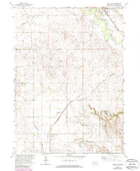
1963 Map of Neligh SE
USGS Topo · Published 1986About this map
The Elkhorn River winds through the northeastern corner of this Antelope County landscape, serving as a focal point for the early 1960s development around Neligh. This area shows the intersection of mid-century infrastructure and agricultural tradition, where the Chicago and North Western railroad cuts a diagonal path across the drainage of Blacksnake Creek. Notable local landmarks include the Neligh Airport and a Drive-in Theater situated just outside the city limits, illustrating the era's transition toward automobile-centric recreation. Further south, the map documents rural life through the presence of the Shelton Sch and important community burial sites like St Boniface Cem and West Cedar Valley Cem. The topography is defined by the dissection of the uplands by Antelope Creek and its tributaries, showing a mix of established farmsteads and resource extraction at the Gravel Pit near the river.
Find a feature on this map
14 named features on this map. Tap any name to fly to it.
Don’t see what you’re looking for? This feature index may not catch every label — zoom into the map to look around manually.
Map Details
Editions of this 1963 Neligh SE Map
2 editions found

Other maps of this area

1955 · Broken Bow
USGS Topo · 1:250,000

1955 · Sioux City
USGS Topo · 1:250,000

1955 · Fremont
USGS Topo · 1:250,000

1955 · O'Neill
USGS Topo · 1:250,000

1956 · Broken Bow
USGS Topo · 1:250,000

1957 · Fremont
USGS Topo · 1:250,000

1958 · Sioux City
USGS Topo · 1:250,000

1958 · Fremont
USGS Topo · 1:250,000

1959 · O'Neill
USGS Topo · 1:250,000

1959 · Sioux City
USGS Topo · 1:250,000