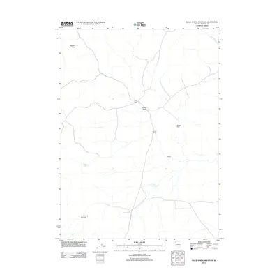
2011 Map of Nellie Spring Mountain
USGS Topo · Published 2011About this map
Grassy Ranch and Stevens Ranch serve as isolated markers of human activity in this arid corner of Washoe County. The landscape is defined by its water sources and high-desert terrain, with the Massacre Range and Nellie Spring Mountain anchoring the topography. Water, though seasonal, is traced through features like Grassy Wash, High Rock Creek, and the Argon Reservoir. The map reveals a reliance on natural springs, including Indian Spring and Fern Spring, which likely dictated the placement of these remote outposts. The winding High Rock Canyon Rd provides the primary passage through this environment, connecting the ranches with the geographic landmarks of Grassy Canyon and Grassy Rock. This 2011 survey documents a sparsely settled region where ranching and topography are deeply intertwined.
Find a feature on this map
13 named features on this map. Tap any name to fly to it.
Don’t see what you’re looking for? This feature index may not catch every label — zoom into the map to look around manually.
Map Details
Editions of this 2011 Nellie Spring Mountain Map
This is the sole edition of this map. No revisions or reprints were ever made.
Other maps of this area

1889 · Long Valley
USGS Topo · 1:250,000

1954 · Vya
USGS Topo · 1:250,000

1958 · Vya
USGS Topo · 1:250,000

1962 · Vya
USGS Topo · 1:250,000

1966 · Nut Mountain
USGS Topo · 1:24,000

1966 · Massacre Creek
USGS Topo · 1:24,000

1966 · Painted Point
USGS Topo · 1:24,000

1972 · Mahogany Mtn
USGS Topo · 1:24,000
1972 · Yellow Hills West
USGS Topo · 1:24,000

1978 · Hart Mountain
USGS Topo · 1:24,000