
1966 Map of Painted Point
USGS Topo · Published 1969About this map
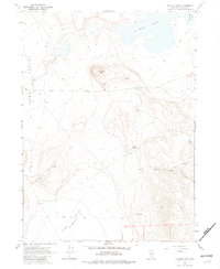
Painted Point rises as a central landmark over the high desert terrain of Washoe County in the mid-1960s. This survey illustrates a landscape dominated by the Long Valley depression, where water sources are vital but scattered. The presence of numerous named springs, including Sand Spring, Lone Spring, and Twin Springs, suggests the historical importance of these points for travelers and livestock in an otherwise arid environment. The northern reaches of the quadrangle are defined by the expansive West Lake and the edge of Middle Lake, which fluctuate within the basin. Navigation through the Black Hills and across the Dip is limited to a network of jeep trails and older trails, reflecting the land's use for grazing or exploration rather than permanent settlement.
Find a feature on this map
17 named features on this map. Tap any name to fly to it.
Don’t see what you’re looking for? This feature index may not catch every label — zoom into the map to look around manually.
Map Details
Editions of this 1966 Painted Point Map
2 editions found
Other maps of this area

1889 · Long Valley
USGS Topo · 1:250,000

1954 · Vya
USGS Topo · 1:250,000

1958 · Vya
USGS Topo · 1:250,000

1962 · Vya
USGS Topo · 1:250,000

1966 · Massacre Lake NW
USGS Topo · 1:24,000

1966 · Vya
USGS Topo · 1:24,000

1966 · Massacre Lake
USGS Topo · 1:24,000

1966 · Alkali Lake
USGS Topo · 1:24,000

1966 · Massacre Creek
USGS Topo · 1:24,000
1979 · Powers Well
USGS Topo · 1:24,000