
1966 Map of Massacre Creek
USGS Topo · Published 1969About this map
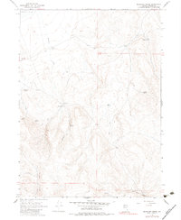
Massacre Creek flows through this high desert region of Washoe County, a landscape defined by critical water sources and remote outposts during the mid-1960s. The presence of Massacre Ranch and Coyote Camp highlights the area's history of cattle ranching and seasonal habitation. This survey records a network of vital springs, including Emigrant Spring, Twin Springs, and Willow Spring, which served as essential waypoints in an otherwise arid environment.
Find a feature on this map
18 named features on this map. Tap any name to fly to it.
Don’t see what you’re looking for? This feature index may not catch every label — zoom into the map to look around manually.
Map Details
Editions of this 1966 Massacre Creek Map
2 editions found
Other maps of this area

1889 · Long Valley
USGS Topo · 1:250,000

1954 · Vya
USGS Topo · 1:250,000

1958 · Vya
USGS Topo · 1:250,000

1962 · Vya
USGS Topo · 1:250,000

1966 · Badger Mtn NW
USGS Topo · 1:24,000

1966 · Massacre Lake NW
USGS Topo · 1:24,000

1966 · Massacre Lake
USGS Topo · 1:24,000

1966 · Nut Mountain
USGS Topo · 1:24,000

1966 · Painted Point
USGS Topo · 1:24,000
1972 · Yellow Hills West
USGS Topo · 1:24,000