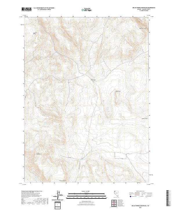
2021 Map of Nellie Spring Mountain
USGS Topo · Published 2021About this map
The Massacre Range dominates this corner of Washoe County, defining a landscape shaped by intermittent water and steep elevation. Local landmarks like Nellie Spring Mtn and the sheer walls of High Rock Canyon provide orientation in this remote high-desert environment. This 2021 survey details the essential water sources that have historically supported transit and livestock through this territory, from the Argon Reservoir to isolated points like Lower Indian Spring, Indian Spring, and Fern Spring. Transportation is limited to rugged tracks, most notably High Rock Canyon Rd, which follows the natural drainage of High Rock Cr. The naming conventions found here, such as Grassy Wash and Grassy Canyon, speak to the sparse vegetation patterns and seasonal grazing potential of the Great Basin.
Find a feature on this map
17 named features on this map. Tap any name to fly to it.
Don’t see what you’re looking for? This feature index may not catch every label — zoom into the map to look around manually.
Map Details
Editions of this 2021 Nellie Spring Mountain Map
This is the sole edition of this map. No revisions or reprints were ever made.
Other maps of this area

1889 · Long Valley
USGS Topo · 1:250,000

1954 · Vya
USGS Topo · 1:250,000

1958 · Vya
USGS Topo · 1:250,000

1962 · Vya
USGS Topo · 1:250,000

1966 · Nut Mountain
USGS Topo · 1:24,000

1966 · Massacre Creek
USGS Topo · 1:24,000

1966 · Painted Point
USGS Topo · 1:24,000

1972 · Mahogany Mtn
USGS Topo · 1:24,000
1972 · Yellow Hills West
USGS Topo · 1:24,000

1978 · Hart Mountain
USGS Topo · 1:24,000