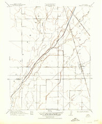
1912 Map of Nelson
USGS Topo · Published 1947About this map
Butte Creek meanders through the heart of this Sacramento Valley landscape, illustrating the complex drainage patterns of Butte County before modern large-scale water management projects. Surveyed in 1910, the map captures a period of significant transit transition as the Northern Electric R. R. and the Southern Pacific (Marysville Line) both bisect the region, serving the agrarian communities of Nelson and Esquon. The intricate network of seasonal waterways, including Durham Slough and Ash Creek, highlights the low-lying terrain and the importance of natural drainage for the surrounding ranchlands. The boundary between Butte Co and Glenn Co is clearly demarcated, providing a valuable reference for local historians and genealogists tracing early 20th-century property lines and regional development.
Find a feature on this map
11 named features on this map. Tap any name to fly to it.
Don’t see what you’re looking for? This feature index may not catch every label — zoom into the map to look around manually.
Map Details
Editions of this 1912 Nelson Map
2 editions found

Other maps of this area

1888 · Marysville
USGS Topo · 1:125,000

1891 · Chico
USGS Topo · 1:125,000

1891 · Marysville
USGS Topo · 1:125,000

1893 · Chico
USGS Topo · 1:125,000

1894 · Marysville
USGS Topo · 1:125,000

1895 · Marysville
USGS Topo · 1:125,000

1895 · Chico
USGS Topo · 1:125,000

1911 · Landlow
USGS Topo · 1:31,680

1912 · Dry Creek
USGS Topo · 1:31,680

1912 · Durham
USGS Topo · 1:31,680