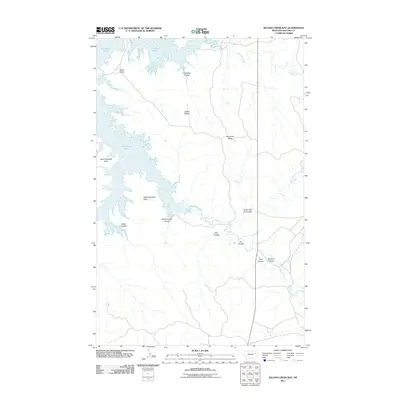
2011 Map of Nelson Creek Bay
USGS Topo · Published 2011About this map
Fort Peck Lake defines the northern and western reaches of this landscape, where the Missouri River's impoundment creates deep inlets like Nelson Creek Bay and McGuire Creek Bay. This terrain is characterized by a complex network of coulees and ridges, such as Racetrack Ridge and Jacks Ridge, which separate the various drainage basins feeding into the lake. The presence of Carney Springs near the headwaters of Nelson Creek suggests vital water sources for ranching in this McCone County region. Shoreline features including North Twitchell Point and Jacks Point mark the interface between the high plains and the reservoir, showing how the landscape was altered by mid-century infrastructure projects. The map captures the specialized geography of the Big Sky country, from Coal Bank Coulee to the remote cattle-grazing lands surrounding Romine Coulee.
Find a feature on this map
19 named features on this map. Tap any name to fly to it.
Don’t see what you’re looking for? This feature index may not catch every label — zoom into the map to look around manually.
Map Details
Editions of this 2011 Nelson Creek Bay Map
This is the sole edition of this map. No revisions or reprints were ever made.
Other maps of this area

1954 · Jordan
USGS Topo · 1:250,000

1956 · Jordan
USGS Topo · 1:250,000

1958 · Jordan
USGS Topo · 1:250,000

1964 · Jordan
USGS Topo · 1:250,000

1967 · Frank Coulee
USGS Topo · 1:24,000

1972 · Short Creek
USGS Topo · 1:24,000

1972 · Ash Creek East
USGS Topo · 1:24,000

1973 · Crow Springs
USGS Topo · 1:24,000

1973 · Rodgers Hall
USGS Topo · 1:24,000

1973 · Nelson Creek Bay
USGS Topo · 1:24,000