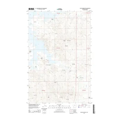
2014 Map of Nelson Creek Bay
USGS Topo · Published 2014About this map
Fort Peck Lake and its intricate northern shoreline dominate this portion of McCone County, where the rising water has created several distinct inlets and landmarks. Nelson Creek Bay reaches deep into the land, flanked by prominent topographic features such as North Twitchell Point and South Twitchell Point. The landscape is defined by a dense network of coulees that drain toward the reservoir, including South Foster Coulee and Jim Coulee. These drainage patterns reflect the erosion typical of the Missouri River breaks region, with ridges like Racetrack Ridge and Jacks Ridge providing high ground between the draws. In the south, the terrain levels out at Egan Flat, while the presence of Carney Springs indicates localized water sources in an otherwise dry landscape of badlands and ridges. Rural access is maintained through the primitive Nelson Creek Rd and Horse Creek Rd.
Find a feature on this map
32 named features on this map. Tap any name to fly to it.
Don’t see what you’re looking for? This feature index may not catch every label — zoom into the map to look around manually.
Map Details
Editions of this 2014 Nelson Creek Bay Map
This is the sole edition of this map. No revisions or reprints were ever made.
Other maps of this area

1954 · Jordan
USGS Topo · 1:250,000

1956 · Jordan
USGS Topo · 1:250,000

1958 · Jordan
USGS Topo · 1:250,000

1964 · Jordan
USGS Topo · 1:250,000

1967 · Frank Coulee
USGS Topo · 1:24,000

1972 · Short Creek
USGS Topo · 1:24,000

1972 · Ash Creek East
USGS Topo · 1:24,000

1973 · Crow Springs
USGS Topo · 1:24,000

1973 · Rodgers Hall
USGS Topo · 1:24,000

1973 · Nelson Creek Bay
USGS Topo · 1:24,000