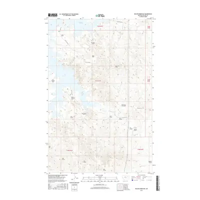
2017 Map of Nelson Creek Bay
USGS Topo · Published 2017About this map
Nelson Creek Bay and McGuire Creek Bay dominate this McCone County landscape, where the Missouri River's backwaters reach deep into a highly eroded coulee system. The complex shoreline is defined by prominent landmarks like Jacks Point and the dual elevations of North Twitchell Point and South Twitchell Point. Further inland, the terrain transitions into a series of ridges and flats, including Racetrack Ridge and Egan Flat. Named features such as Carney Springs and the winding Nelson Creek suggest historical water access points in an otherwise arid environment. Numerous coulees, including South Foster Coulee and Shot Coulee, demonstrate the intense drainage patterns that have shaped the breaks surrounding the Dry Arm. This map provides a look at the interplay between the reservoir waters and the traditional ranchland topography of eastern Montana.
Find a feature on this map
34 named features on this map. Tap any name to fly to it.
Don’t see what you’re looking for? This feature index may not catch every label — zoom into the map to look around manually.
Map Details
Editions of this 2017 Nelson Creek Bay Map
This is the sole edition of this map. No revisions or reprints were ever made.
Other maps of this area

1954 · Jordan
USGS Topo · 1:250,000

1956 · Jordan
USGS Topo · 1:250,000

1958 · Jordan
USGS Topo · 1:250,000

1964 · Jordan
USGS Topo · 1:250,000

1967 · Frank Coulee
USGS Topo · 1:24,000

1972 · Short Creek
USGS Topo · 1:24,000

1972 · Ash Creek East
USGS Topo · 1:24,000

1973 · Crow Springs
USGS Topo · 1:24,000

1973 · Rodgers Hall
USGS Topo · 1:24,000

1973 · Nelson Creek Bay
USGS Topo · 1:24,000