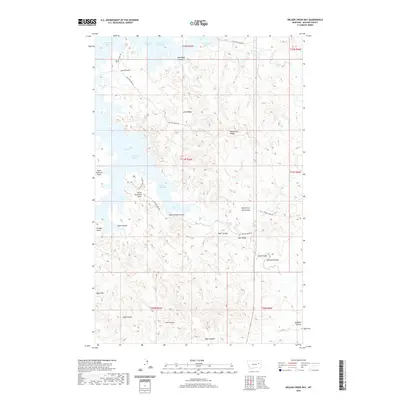
2020 Map of Nelson Creek Bay
USGS Topo · Published 2020About this map
Fort Peck Lake dominates the western edge of this landscape in McCone County, where the rising waters of the Missouri River reservoir have created a complex shoreline of inlets and points. The map documents the intricate geography of McGuire Creek Bay and Nelson Creek Bay, where the prairie breaks into numerous coulees that drain toward the reservoir. High ground such as Jacks Ridge and Racetrack Ridge provides a stark contrast to the surrounding drainage systems, including North Fork Jim Coulee and Romine Coulee. This 2020 survey illustrates the modern ranching and recreational infrastructure of the region, featuring a network of rural routes like McGuire Creek Rd and Nelson Creek Rd that navigate the varied terrain between Egan Flat and the water’s edge at Stubby Point.
Find a feature on this map
38 named features on this map. Tap any name to fly to it.
Don’t see what you’re looking for? This feature index may not catch every label — zoom into the map to look around manually.
Map Details
Editions of this 2020 Nelson Creek Bay Map
This is the sole edition of this map. No revisions or reprints were ever made.
Other maps of this area

1954 · Jordan
USGS Topo · 1:250,000

1956 · Jordan
USGS Topo · 1:250,000

1958 · Jordan
USGS Topo · 1:250,000

1964 · Jordan
USGS Topo · 1:250,000

1967 · Frank Coulee
USGS Topo · 1:24,000

1972 · Short Creek
USGS Topo · 1:24,000

1972 · Ash Creek East
USGS Topo · 1:24,000

1973 · Crow Springs
USGS Topo · 1:24,000

1973 · Rodgers Hall
USGS Topo · 1:24,000

1973 · Nelson Creek Bay
USGS Topo · 1:24,000