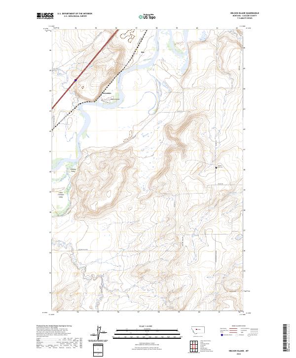
2024 Map of Nelson Island
USGS Topo · Published 2024About this map
Nelson Island lies at a significant bend of the Missouri River in this part of Cascade County, where the river winds through a landscape defined by seasonal creek drainages and small ranching communities. The map details the transition from the river valley to higher ground, noting established locales such as Ulm and Riverdale. Significant local history is preserved in the placement of Castner Falls Cem, situated east of the river near Baker Rd. The road network, including Old Ulm Cascade Rd and Old US Hwy 91, reflects the long-standing transportation corridors that followed the river's path. Settled areas like Chestnut Valley and Lower Chestnut Valley indicate the early agricultural and social centers of the region, while naming conventions for features like Bird Creek and Geyser Creek highlight the importance of water resources in this Montana landscape.
Find a feature on this map
25 named features on this map. Tap any name to fly to it.
Don’t see what you’re looking for? This feature index may not catch every label — zoom into the map to look around manually.
Map Details
Editions of this 2024 Nelson Island Map
This is the sole edition of this map. No revisions or reprints were ever made.
Other maps of this area

1886 · Great Falls
USGS Topo · 1:250,000

1949 · Cascade
USGS Topo · 1:62,500

1951 · Cascade
USGS Topo · 1:62,500

1954 · Great Falls
USGS Topo · 1:250,000

1955 · Gore Hill
USGS Topo · 1:62,500

1957 · Great Falls
USGS Topo · 1:250,000

1961 · Rocky Reef
USGS Topo · 1:24,000

1961 · Schrammeck Lake
USGS Topo · 1:24,000
1965 · Antelope Butte
USGS Topo · 1:24,000
1965 · Truly
USGS Topo · 1:24,000