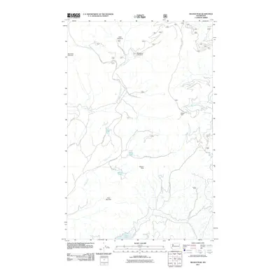
2011 Map of Nelson Peak
USGS Topo · Published 2011About this map
Betts Meadows and Woodward Meadows define the high-altitude hydrology of this Stevens County landscape, where the headwaters of Cottonwood Creek and Grouse Creek begin their descent. This 2011 survey illustrates a region largely characterized by its peaks and drainage basins, with Nelson Peak and Benson Peak standing as prominent landmarks. The settlement pattern is sparse, represented by Camp Hafer in the north and Kaniksu Ranch toward the east. The map provides a clear look at the network of forest and county roads, such as Nelson Lake Rd and Benson Lake Rd, which link several small alpine bodies of water including Buzzard Lake, Nelson Lake, and Benson Lake. In the southern reaches, the map captures the northern edge of Deer Lake, a significant recreational and geographical feature for the area.
Find a feature on this map
28 named features on this map. Tap any name to fly to it.
Don’t see what you’re looking for? This feature index may not catch every label — zoom into the map to look around manually.
Map Details
Editions of this 2011 Nelson Peak Map
This is the sole edition of this map. No revisions or reprints were ever made.
Other maps of this area

1927 · Chewelah
USGS Topo · 1:125,000

1930 · Chewelah
USGS Topo · 1:125,000

1936 · Newport
USGS Topo · 1:96,000

1942 · Newport
USGS Topo · 1:125,000

1958 · Sandpoint
USGS Topo · 1:250,000

1963 · Sandpoint
USGS Topo · 1:250,000

1964 · Chewelah
USGS Topo · 1:24,000

1964 · Goddards Peak
USGS Topo · 1:24,000

1964 · Chewelah Mtn
USGS Topo · 1:62,500
1965 · Valley
USGS Topo · 1:24,000