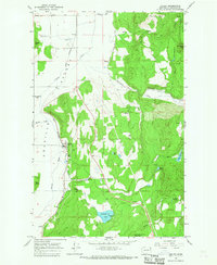
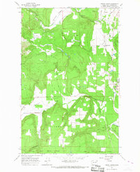
1965 Map of Valley
USGS Topo · Published 1967About this map
The Great Northern railroad corridor serves as the industrial spine for this Stevens County region in the mid-1960s, following the natural path of the Colville River valley. The small community of Valley serves as a primary point of reference, situated where Waitts Creek meets the river. To the east, the landscape rises sharply into the Colville National Forest, characterized by numerous named peaks like Parker Mtn and Roundtop Mtn.
Find a feature on this map
34 named features on this map. Tap any name to fly to it.
Don’t see what you’re looking for? This feature index may not catch every label — zoom into the map to look around manually.
Map Details
Editions of this 1965 Valley Map
Other maps of this area

1927 · Chewelah
USGS Topo · 1:125,000

1930 · Chewelah
USGS Topo · 1:125,000

1958 · Sandpoint
USGS Topo · 1:250,000

1963 · Sandpoint
USGS Topo · 1:250,000

1964 · Chewelah
USGS Topo · 1:24,000

1964 · Goddards Peak
USGS Topo · 1:24,000

1964 · Chewelah Mtn
USGS Topo · 1:62,500

1965 · Waitts Lake
USGS Topo · 1:24,000
1965 · Addy
USGS Topo · 1:24,000
1965 · Forest Center
USGS Topo · 1:24,000