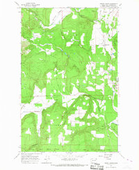
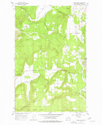
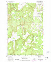
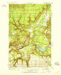
1965 Map of Forest Center
USGS Topo · Published 1967About this map
Forest Center stands at a transition between the timbered slopes of southern Stevens County and the open marshlands of the Colville River valley in the mid-1960s. The landscape is defined by the Great Northern railway corridor, which connects the small settlement of Cline and the northern edge of Springdale. Further south, the Spokane Indian Reservation Boundary marks a clear division in land use, where the terrain shifts toward more dissected topography near Sorenson and Lyons Hill.
Find a feature on this map
33 named features on this map. Tap any name to fly to it.
Don’t see what you’re looking for? This feature index may not catch every label — zoom into the map to look around manually.
Map Details
Editions of this 1965 Forest Center Map
Other maps of this area

1927 · Chewelah
USGS Topo · 1:125,000

1930 · Chewelah
USGS Topo · 1:125,000

1944 · Clayton
USGS Topo · 1:62,500

1944 · Wellpinit
USGS Topo · 1:62,500

1950 · Clayton
USGS Topo · 1:62,500
1953 · Wellpinit
USGS Topo · 1:62,500

1955 · Spokane
USGS Topo · 1:250,000

1958 · Spokane
USGS Topo · 1:250,000

1958 · Sandpoint
USGS Topo · 1:250,000

1963 · Sandpoint
USGS Topo · 1:250,000