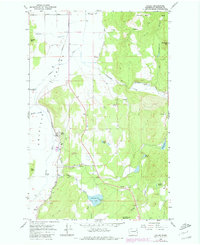
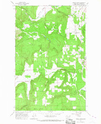
1965 Map of Valley
USGS Topo · Published 1980About this map
The Colville River flows through a broad valley floor where the Great Northern railroad dictates the local geography of Stevens County. Near the settlement of Valley, the landscape transitions from the river bottom to prominent peaks like Wrights Mtn and Jumpoff Joe Mountain. The placement of infrastructure, such as the Gaging Sta on Jumpoff Joe Lake and the various quarries and gravel pits, reveals a mid-century economy focused on resource management and transport.
Find a feature on this map
37 named features on this map. Tap any name to fly to it.
Don’t see what you’re looking for? This feature index may not catch every label — zoom into the map to look around manually.
Map Details
Editions of this 1965 Valley Map
Other maps of this area

1927 · Chewelah
USGS Topo · 1:125,000

1930 · Chewelah
USGS Topo · 1:125,000

1958 · Sandpoint
USGS Topo · 1:250,000

1963 · Sandpoint
USGS Topo · 1:250,000

1964 · Chewelah
USGS Topo · 1:24,000

1964 · Goddards Peak
USGS Topo · 1:24,000

1964 · Chewelah Mtn
USGS Topo · 1:62,500

1965 · Waitts Lake
USGS Topo · 1:24,000
1965 · Addy
USGS Topo · 1:24,000
1965 · Forest Center
USGS Topo · 1:24,000