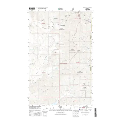
2014 Map of Nelson Peak
USGS Topo · Published 2014About this map
Nelson Peak and Benson Peak dominate this corner of the Selkirk Mountains, where the boundaries of Colville National Forest and Kaniksu National Forest converge. The landscape is defined by its dramatic relief and a network of Forest Service roads, including Nelson Lake Rd and Grouse Creek Branch Rd, which provide access to high-altitude water bodies like Nelson Lake and Benson Lake.
Find a feature on this map
33 named features on this map. Tap any name to fly to it.
Don’t see what you’re looking for? This feature index may not catch every label — zoom into the map to look around manually.
Map Details
Editions of this 2014 Nelson Peak Map
This is the sole edition of this map. No revisions or reprints were ever made.
Other maps of this area

1927 · Chewelah
USGS Topo · 1:125,000

1930 · Chewelah
USGS Topo · 1:125,000

1936 · Newport
USGS Topo · 1:96,000

1942 · Newport
USGS Topo · 1:125,000

1958 · Sandpoint
USGS Topo · 1:250,000

1963 · Sandpoint
USGS Topo · 1:250,000

1964 · Chewelah
USGS Topo · 1:24,000

1964 · Goddards Peak
USGS Topo · 1:24,000

1964 · Chewelah Mtn
USGS Topo · 1:62,500
1965 · Valley
USGS Topo · 1:24,000