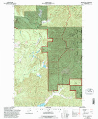
1992 Map of Nelson Peak
USGS Topo · Published 1996About this map
Nelson Peak and the high ridges of the Colville National Forest dominate this northeastern Washington landscape, marking the transition between the mountains and the waters of Deer Lake. The map reveals a high-altitude network of resource management and early recreation, evidenced by Camp Hafer and the Kenwood Ranch at the lower elevations. The forest service road system, including the Upper Cottonwood Road and Cottonwood Divide Road, suggests a history of timber access and fire lookout logistics.
Find a feature on this map
24 named features on this map. Tap any name to fly to it.
Don’t see what you’re looking for? This feature index may not catch every label — zoom into the map to look around manually.
Map Details
Editions of this 1992 Nelson Peak Map
This is the sole edition of this map. No revisions or reprints were ever made.
Other maps of this area

1927 · Chewelah
USGS Topo · 1:125,000

1930 · Chewelah
USGS Topo · 1:125,000

1936 · Newport
USGS Topo · 1:96,000

1942 · Newport
USGS Topo · 1:125,000

1958 · Sandpoint
USGS Topo · 1:250,000

1963 · Sandpoint
USGS Topo · 1:250,000

1964 · Chewelah
USGS Topo · 1:24,000

1964 · Goddards Peak
USGS Topo · 1:24,000

1964 · Chewelah Mtn
USGS Topo · 1:62,500
1965 · Valley
USGS Topo · 1:24,000