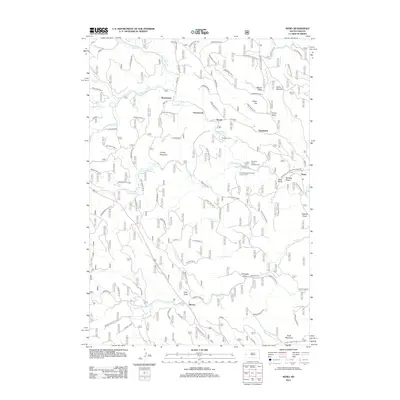
2012 Map of Nemo
USGS Topo · Published 2012About this map
The settlement of Nemo serves as a primary hub in this Black Hills landscape, where the confluence of Estes Creek and Boxelder Creek dictates the local geography. The map reveals a transition between rural residential pockets and Forest Service lands, with clusters of development at Novak, Tomahawk, and the South Boxelder Summer Home Group. This 2012 survey illustrates a complex network of forest roads and trails, such as Nemo Road and Lucky Strike Road, which provide access to high-elevation points like Crystal Mountain and Pilot Knob. Significant recreational and residential features are present, including the Box Elder Forks Campground and small clusters of homes at Benchmark and Merritt. The drainage patterns of the various forks of Estes Creek and Jim Creek define the ridges and draws, highlighting the intricate topography surrounding Greenwood and Buck Mountain.
Find a feature on this map
93 named features on this map. Tap any name to fly to it.
Don’t see what you’re looking for? This feature index may not catch every label — zoom into the map to look around manually.
Map Details
Editions of this 2012 Nemo Map
This is the sole edition of this map. No revisions or reprints were ever made.
Other maps of this area

1893 · Rapid
USGS Topo · 1:125,000

1894 · Deadwood
USGS Topo · 1:125,000

1898 · Rapid
USGS Topo · 1:125,000

1899 · Sturgis
USGS Topo · 1:62,500

1901 · Deadwood
USGS Topo · 1:125,000

1903 · Rapid
USGS Topo · 1:125,000

1915 · Sturgis
USGS Topo · 1:62,500

1916 · Deadwood
USGS Topo · 1:125,000

1953 · Piedmont
USGS Topo · 1:24,000

1953 · Nemo
USGS Topo · 1:24,000