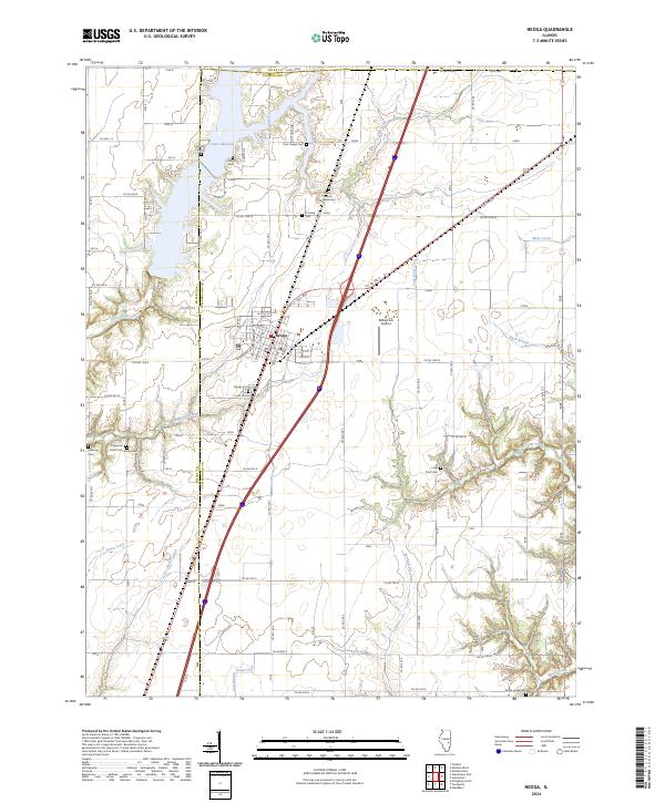
2024 Map of Neoga
USGS Topo · Published 2024About this map
Neoga serves as the central hub of this Central Illinois landscape, situated at the intersection of significant transport corridors. The Illinois Central Railroad cuts a straight path through the territory, a physical legacy of the region's historical dependence on rail for agricultural trade. This rail influence is uniquely preserved in the Illinois Central Railroad Cem, one of several small burial grounds such as Crossing Cem and Lockhart Cem that dot the countryside, offering vital points of interest for genealogical research.
Find a feature on this map
57 named features on this map. Tap any name to fly to it.
Don’t see what you’re looking for? This feature index may not catch every label — zoom into the map to look around manually.
Map Details
Editions of this 2024 Neoga Map
This is the sole edition of this map. No revisions or reprints were ever made.
Other maps of this area

1934 · Mattoon
USGS Topo · 1:62,500

1937 · Mattoon
USGS Topo · 1:62,500

1947 · Stewardson
USGS Topo · 1:62,500

1949 · Stewardson
USGS Topo · 1:62,500

1950 · Effingham
USGS Topo · 1:62,500

1951 · Effingham
USGS Topo · 1:62,500

1953 · Teutopolis
USGS Topo · 1:62,500

1958 · Decatur
USGS Topo · 1:250,000

1961 · Decatur
USGS Topo · 1:250,000
1981 · Stewardson East
USGS Topo · 1:24,000