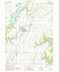
1984 Map of Neoga
USGS Topo · Published 1985About this map
Neoga serves as a central hub for this portion of east-central Illinois, positioned near the intersection of several county boundaries including Shelby Co Cumberland Co and Coles Co Cumberland Co. The landscape is characterized by the regulated waters of Mattoon Lake in the north, featuring a Public Boat Dock and Campground for regional recreation. This 1980s landscape is bifurcated by the Illinois Central Gulf railroad and several Natural Gas Pipelines, illustrating the area's role in the transit and energy infrastructure of the period.
Find a feature on this map
23 named features on this map. Tap any name to fly to it.
Don’t see what you’re looking for? This feature index may not catch every label — zoom into the map to look around manually.
Map Details
Editions of this 1984 Neoga Map
This is the sole edition of this map. No revisions or reprints were ever made.
Other maps of this area

1934 · Mattoon
USGS Topo · 1:62,500

1937 · Mattoon
USGS Topo · 1:62,500

1947 · Stewardson
USGS Topo · 1:62,500

1949 · Stewardson
USGS Topo · 1:62,500

1950 · Effingham
USGS Topo · 1:62,500

1951 · Effingham
USGS Topo · 1:62,500

1953 · Teutopolis
USGS Topo · 1:62,500

1958 · Decatur
USGS Topo · 1:250,000

1961 · Decatur
USGS Topo · 1:250,000
1981 · Stewardson East
USGS Topo · 1:24,000