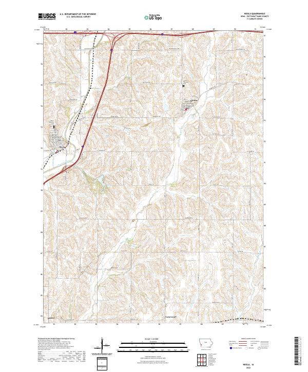
2022 Map of Neola
USGS Topo · Published 2022About this map
Neola and Minden serve as the primary hubs for this agricultural region in Pottawattamie County, connected by the historical corridor of the Railroad Hwy. The landscape is defined by the winding paths of Mosquito Creek and Keg Creek, which carve through the undulating terrain typical of western Iowa. Smaller local centers like Bentley and York Center anchor the southern portions of the map, providing key reference points for genealogical research in an area where township life was historically organized around these small community clusters.
Find a feature on this map
37 named features on this map. Tap any name to fly to it.
Don’t see what you’re looking for? This feature index may not catch every label — zoom into the map to look around manually.
Map Details
Editions of this 2022 Neola Map
This is the sole edition of this map. No revisions or reprints were ever made.
Other maps of this area

1954 · Omaha
USGS Topo · 1:250,000

1956 · Underwood
USGS Topo · 1:24,000

1956 · Neola
USGS Topo · 1:24,000

1956 · Mc Clelland
USGS Topo · 1:24,000

1957 · Omaha
USGS Topo · 1:250,000

1957 · Taylor
USGS Topo · 1:24,000

1958 · Omaha
USGS Topo · 1:250,000

1963 · Avoca NW
USGS Topo · 1:24,000

1963 · Oakland
USGS Topo · 1:24,000
1978 · Hard Scratch
USGS Topo · 1:24,000