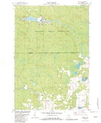
1982 Map of Neopit
USGS Topo · Published 1982About this map
The Menominee Indian Reservation landscape is defined by the winding waters of the West Branch Wolf River and its numerous tributaries. In the northern section, the settlement of Neopit serves as a focal point, situated adjacent to the Neopit Mill Pond and near the St Anthonys Cem. The map illustrates the complex boundary lines of the region, including the Old Indian Treaty Boundary and the Stockbridge-Munsee Indian Reservation Boundary, reflecting the area's significant tribal history. Further south, the terrain transitions into the town of Red Springs, where smaller communities like Morgan and Beaulieu are found alongside local landmarks such as the Immanuel-Mohican Ch and Red Springs Cem. The abundance of glacial lakes, including Island Lake, Big Lake, and Beaulieu Lake, suggests a geography shaped by water and timber, with recreational sites like the Pine Hills Golf Club emerging in the later twentieth century.
Find a feature on this map
50 named features on this map. Tap any name to fly to it.
Don’t see what you’re looking for? This feature index may not catch every label — zoom into the map to look around manually.
Map Details
Editions of this 1982 Neopit Map
This is the sole edition of this map. No revisions or reprints were ever made.
Other maps of this area

1952 · White Lake
USGS Topo · 1:48,000

1952 · Langlade
USGS Topo · 1:48,000

1954 · Gresham
USGS Topo · 1:48,000

1954 · Shawano
USGS Topo · 1:48,000

1954 · Iron Mountain
USGS Topo · 1:250,000

1955 · Green Bay
USGS Topo · 1:250,000

1959 · Iron Mountain
USGS Topo · 1:250,000

1964 · Shawano
USGS Topo · 1:62,500

1964 · Gresham
USGS Topo · 1:62,500
1973 · Perote Lake
USGS Topo · 1:24,000