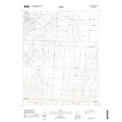
2017 Map of Neosho East
USGS Topo · Published 2017About this map
The eastern edges of Neosho give way to the rugged drainage basins of Newton Co and McDonald Co in this modern topographic study. The landscape is defined by the winding course of Hickory Cr and the deep incisions of Bullskin Cr and Indian Creek, where the terrain drops into Happy Hollow and Pottershop Hollow. This area reflects a mix of institutional presence and rural settlement, anchored by the campus of Crowder Coll on the southwestern outskirts of the city.
Find a feature on this map
64 named features on this map. Tap any name to fly to it.
Don’t see what you’re looking for? This feature index may not catch every label — zoom into the map to look around manually.
Map Details
Editions of this 2017 Neosho East Map
This is the sole edition of this map. No revisions or reprints were ever made.
Other maps of this area

1916 · Neosho
USGS Topo · 1:62,500

1940 · Noel
USGS Topo · 1:62,500

1941 · Rocky Comfort
USGS Topo · 1:62,500

1943 · Ritchey
USGS Topo · 1:62,500

1943 · Noel
USGS Topo · 1:62,500

1943 · Rocky Comfort
USGS Topo · 1:62,500

1954 · Tulsa
USGS Topo · 1:250,000

1958 · Tulsa
USGS Topo · 1:250,000

1963 · Tulsa
USGS Topo · 1:250,000
1972 · Granby
USGS Topo · 1:24,000