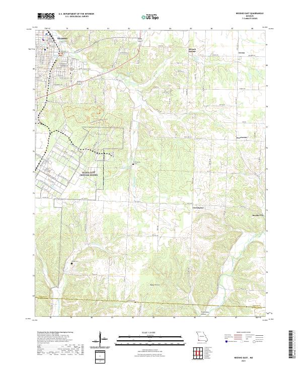
2021 Map of Neosho East
USGS Topo · Published 2021About this map
Neosho serves as the primary hub of this eastern Newton County landscape, where the Newton County Courthouse stands near several prominent water sources including Big Spring and Hearrell Spring. The area reflects a transition from the structured street grid of the county seat to a more dispersed rural character, marked by historic communities such as Monark Springs, Sweetwater, and Aroma. Educational and civic life is anchored by Crowder College in the west, while the southern reaches descend into natural depressions like Happy Hollow and Pottershop Hollow. Several burial grounds, including Odd Fellows Cem, Elm Spring Cem, and Maness Cem, provide specific points of interest for genealogical research. The drainage patterns of Bullskin Cr and Indian Creek define the southern terrain, illustrating the water-rich topography that influenced the placement of early settlements and springs throughout the region.
Find a feature on this map
102 named features on this map. Tap any name to fly to it.
Don’t see what you’re looking for? This feature index may not catch every label — zoom into the map to look around manually.
Map Details
Editions of this 2021 Neosho East Map
This is the sole edition of this map. No revisions or reprints were ever made.
Other maps of this area

1916 · Neosho
USGS Topo · 1:62,500

1940 · Noel
USGS Topo · 1:62,500

1941 · Rocky Comfort
USGS Topo · 1:62,500

1943 · Ritchey
USGS Topo · 1:62,500

1943 · Noel
USGS Topo · 1:62,500

1943 · Rocky Comfort
USGS Topo · 1:62,500

1954 · Tulsa
USGS Topo · 1:250,000

1958 · Tulsa
USGS Topo · 1:250,000

1963 · Tulsa
USGS Topo · 1:250,000
1972 · Granby
USGS Topo · 1:24,000