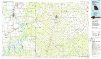
1986 Map of Neosho
USGS Topo · Published 1986About this map
Neosho serves as a central hub in this mid-1980s look at the tri-state border region where Missouri, Oklahoma, and Kansas meet. The map documents a landscape defined by both industrial history and water-based recreation, prominently featuring the Grand Lake O' The Cherokees and the Neosho River valley. To the west, the intensive legacy of the Tri-State Mining District is visible near Picher and Cardin, where Lead and Zinc Mines are noted on the landscape. This era captures the region prior to major environmental remediation efforts in these mining communities. Cultural landmarks such as the George Washington Carver National Monument and Crowder College are shown alongside a dense network of country churches and cemeteries like Bethpage Ch and the IOOF Cem, providing essential details for local history and genealogical research.
Find a feature on this map
79 named features on this map. Tap any name to fly to it.
Don’t see what you’re looking for? This feature index may not catch every label — zoom into the map to look around manually.
Map Details
Editions of this 1986 Neosho Map
2 editions found
Other maps of this area

1886 · Joplin
USGS Topo · 1:125,000

1886 · Greenfield
USGS Topo · 1:125,000

1886 · Carthage
USGS Topo · 1:125,000

1886 · Parsons
USGS Topo · 1:125,000

1888 · Greenfield
USGS Topo · 1:125,000

1893 · Parsons
USGS Topo · 1:125,000

1894 · Joplin
USGS Topo · 1:125,000

1894 · Carthage
USGS Topo · 1:125,000

1896 · Pryor
USGS Topo · 1:125,000

1899 · Fayetteville
USGS Topo · 1:125,000