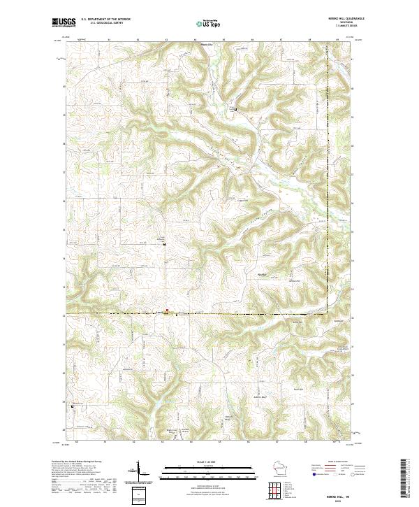
2022 Map of Nerike Hill
USGS Topo · Published 2022About this map
Nerike Hill and the surrounding coulee-cut terrain of Pierce and Pepin counties define this recent topographic study. The landscape is characterized by a network of drainage systems including Plum Creek and Stony Coulee, which separate prominent rises like Cotter Hill and Seine Hill. Small crossroads settlements and agricultural hubs like Plum City and Lund anchor the area, while the rural fabric is preserved in the location of several community burial grounds, such as Lund Methodist Cemetery and Mission Covenant Cemetery. Aviation is surprisingly well-represented in this rural corner of Wisconsin, with several private airstrips like Bogus Creek Airport and Airwolfe Airport appearing near the county line. The map highlights the transition from the high ridges of Farm Hill down to the creek valleys, illustrating the enduring township and range property system.
Find a feature on this map
112 named features on this map. Tap any name to fly to it.
Don’t see what you’re looking for? This feature index may not catch every label — zoom into the map to look around manually.
Map Details
Editions of this 2022 Nerike Hill Map
This is the sole edition of this map. No revisions or reprints were ever made.
Other maps of this area

1932 · Wabasha
USGS Topo · 1:62,500

1935 · Arkansaw
USGS Topo · 1:48,000

1940 · Maiden Rock
USGS Topo · 1:62,500

1941 · Arkansaw
USGS Topo · 1:62,500

1942 · Arkansaw
USGS Topo · 1:62,500

1950 · Maiden Rock
USGS Topo · 1:62,500

1951 · Wabasha
USGS Topo · 1:62,500

1951 · Lake City
USGS Topo · 1:62,500

1953 · Saint Paul
USGS Topo · 1:250,000

1959 · Saint Paul
USGS Topo · 1:250,000