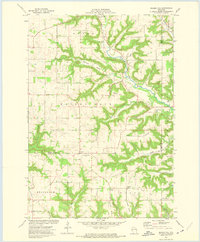
1972 Map of Nerike Hill
USGS Topo · Published 1975About this map
Nerike Hill and the surrounding coulees of Pierce and Pepin Counties define this rural landscape as it appeared in the early 1970s. The region is characterized by a series of steep bluffs and narrow valleys, such as Brunner Valley and Hicks Valley, which have historically dictated the placement of roads and farmsteads. Settlement patterns remain dispersed, anchored by small crossroads and historic religious centers like Lund and Nerike.
Find a feature on this map
35 named features on this map. Tap any name to fly to it.
Don’t see what you’re looking for? This feature index may not catch every label — zoom into the map to look around manually.
Map Details
Editions of this 1972 Nerike Hill Map
This is the sole edition of this map. No revisions or reprints were ever made.
Other maps of this area

1932 · Wabasha
USGS Topo · 1:62,500

1935 · Arkansaw
USGS Topo · 1:48,000

1940 · Maiden Rock
USGS Topo · 1:62,500

1941 · Arkansaw
USGS Topo · 1:62,500

1942 · Arkansaw
USGS Topo · 1:62,500

1950 · Maiden Rock
USGS Topo · 1:62,500

1951 · Wabasha
USGS Topo · 1:62,500

1951 · Lake City
USGS Topo · 1:62,500

1953 · Saint Paul
USGS Topo · 1:250,000

1959 · Saint Paul
USGS Topo · 1:250,000