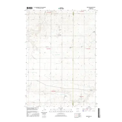
2016 Map of Nerstrand
USGS Topo · Published 2016About this map
Nerstrand sits at the heart of this landscape, serving as a primary point of settlement where local roads converge near the Nerstrand Cem. The surrounding countryside is defined by a dense network of family-named cemeteries and rural congregations, reflecting the deep heritage of European immigrant communities. Traces of these social foundations appear at the German Methodist Episcopal Cem and the Wheeling Evangelical Cem, which anchor the northern and central portions of the survey. The hydrology is dominated by the N Fork Zumbro River and the Little Cannon River, whose winding courses cut through the agricultural sections near Epsom. This mapping reveals a late 20th-century transition where traditional section-line farming roads, such as Kane Ave and Co Rd 26, maintain the grid-like character of the prairie even as the local economy evolved around these small township hubs.
Find a feature on this map
61 named features on this map. Tap any name to fly to it.
Don’t see what you’re looking for? This feature index may not catch every label — zoom into the map to look around manually.
Map Details
Editions of this 2016 Nerstrand Map
This is the sole edition of this map. No revisions or reprints were ever made.
Other maps of this area

1953 · Saint Paul
USGS Topo · 1:250,000

1959 · Saint Paul
USGS Topo · 1:250,000

1960 · Northfield
USGS Topo · 1:24,000

1960 · Cannon City
USGS Topo · 1:24,000

1960 · Dennison
USGS Topo · 1:24,000

1960 · Nerstrand
USGS Topo · 1:24,000

1962 · Medford East
USGS Topo · 1:24,000

1962 · Moland
USGS Topo · 1:24,000

1965 · West Concord
USGS Topo · 1:24,000

1968 · Kenyon
USGS Topo · 1:24,000