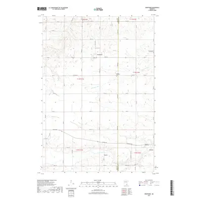
2019 Map of Nerstrand
USGS Topo · Published 2019About this map
Nerstrand sits at the intersection of local routes in a landscape defined by its agricultural heritage and early immigrant settlements. This survey of the Rice and Goodhue County borderlands reveals a network of country churches and burial grounds that anchor the local genealogy, including the German Methodist Episcopal Cem and the Norwegian Lutheran Cem. The topography is marked by the winding paths of the Little Cannon River and the N Fork Zumbro River, which carve through the terrain near the settlement of Epsom. To the southeast, the terrain descends into Monkey Valley, a distinctive hollow that contrasts with the surrounding upland plateaus. The placement of the Wheeling Evangelical Cem and Hauge Cem reflects the distinct denominational pockets that characterized rural Minnesota's development through the twentieth century.
Find a feature on this map
51 named features on this map. Tap any name to fly to it.
Don’t see what you’re looking for? This feature index may not catch every label — zoom into the map to look around manually.
Map Details
Editions of this 2019 Nerstrand Map
This is the sole edition of this map. No revisions or reprints were ever made.
Other maps of this area

1953 · Saint Paul
USGS Topo · 1:250,000

1959 · Saint Paul
USGS Topo · 1:250,000

1960 · Northfield
USGS Topo · 1:24,000

1960 · Cannon City
USGS Topo · 1:24,000

1960 · Dennison
USGS Topo · 1:24,000

1960 · Nerstrand
USGS Topo · 1:24,000

1962 · Medford East
USGS Topo · 1:24,000

1962 · Moland
USGS Topo · 1:24,000

1965 · West Concord
USGS Topo · 1:24,000

1968 · Kenyon
USGS Topo · 1:24,000