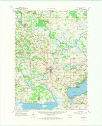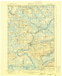
1918 Map of Neshkoro
USGS Topo · Published 1941About this map
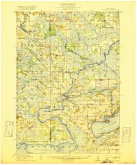
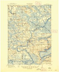
Fox River navigation and the growing rail network of the early twentieth century define this landscape at the intersection of Marquette, Waushara, and Green Lake Counties. The Chicago and Northwestern railroad cuts through the center of the sheet, connecting the settlement at Princeton to points north and south. This period shows the active management of the local waterways, evidenced by the White River Lock and Princeton Lock, which facilitated movement between the river and the surrounding marshlands. A dense network of one-room schoolhouses, such as School No 1 and School No 12, are scattered throughout townships like Seneca and ST Marie, reflecting the dispersed agricultural community of the era. The map also captures significant water bodies including Green Lake and Puckaway Lake, which anchor the southern half of the quadrangle.
Find a feature on this map
60 named features on this map. Tap any name to fly to it.
Don’t see what you’re looking for? This feature index may not catch every label — zoom into the map to look around manually.
Map Details
Editions of this 1918 Neshkoro Map
3 editions found
Historical Maps of Princeton Through Time
9 maps found