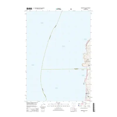
2014 Map of Neskowin OE W
USGS Topo · Published 2014About this map
Lincoln City and the northern edge of the Central Oregon Coast are the focus of this 2014 survey. The map details the transition from the developed northern end of town at Roads End to the protected wilderness of the Siuslaw National Forest. Significant coastal landmarks like Cascade Head and the sea stacks at Three Rocks define the shoreline, where the Pacific Ocean meets a landscape of small drainages such as Cliff Cr and Logan Cr. The residential grid of northern Lincoln City is clearly visible, showing the reach of NW Jetty Ave and NE Sal La Sea Dr toward the cliffs at Roads End Point. This map captures the intersection of residential expansion and environmental preservation during the early 21st century.
Find a feature on this map
22 named features on this map. Tap any name to fly to it.
Don’t see what you’re looking for? This feature index may not catch every label — zoom into the map to look around manually.
Map Details
Editions of this 2014 Neskowin OE W Map
This is the sole edition of this map. No revisions or reprints were ever made.
Other maps of this area

1941 · Nestucca Bay
USGS Topo · 1:62,500

1941 · Cape Foulweather
USGS Topo · 1:62,500

1942 · Euchre Mtn
USGS Topo · 1:62,500

1942 · Nestucca Bay
USGS Topo · 1:62,500

1943 · Euchre Mtn
USGS Topo · 1:62,500

1944 · Cape Foulweather
USGS Topo · 1:62,500

1948 · Vancouver
USGS Topo · 1:250,000

1950 · Vancouver
USGS Topo · 1:250,000

1950 · Vancouver
USGS Topo · 1:250,000

1953 · Salem
USGS Topo · 1:250,000