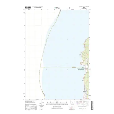
2017 Map of Neskowin OE W
USGS Topo · Published 2017About this map
Cascade Head dominates the rugged coastal interface of this 2017 survey, where the terrestrial wilderness of the Siuslaw National Forest meets the expanse of the Pacific Ocean. This map documents a transitional zone along the border of Tillamook and Lincoln counties, characterized by dramatic shoreline features like Three Rocks and the Oregon Islands National Wildlife Refuge. The southern portion of the sheet provides a detailed look at the northern extent of Lincoln City, showing residential development reaching its terminus at Roads End Point. From the secluded Harts Cove in the north to the network of local streets such as NW Logan Rd and NE Sal La Sea Dr, the topography illustrates the constraints of the coastal shelf, with elevation climbing sharply from the beach toward Coon Lake and the high bluffs overlooking the surf.
Find a feature on this map
23 named features on this map. Tap any name to fly to it.
Don’t see what you’re looking for? This feature index may not catch every label — zoom into the map to look around manually.
Map Details
Editions of this 2017 Neskowin OE W Map
This is the sole edition of this map. No revisions or reprints were ever made.
Other maps of this area

1941 · Nestucca Bay
USGS Topo · 1:62,500

1941 · Cape Foulweather
USGS Topo · 1:62,500

1942 · Euchre Mtn
USGS Topo · 1:62,500

1942 · Nestucca Bay
USGS Topo · 1:62,500

1943 · Euchre Mtn
USGS Topo · 1:62,500

1944 · Cape Foulweather
USGS Topo · 1:62,500

1948 · Vancouver
USGS Topo · 1:250,000

1950 · Vancouver
USGS Topo · 1:250,000

1950 · Vancouver
USGS Topo · 1:250,000

1953 · Salem
USGS Topo · 1:250,000