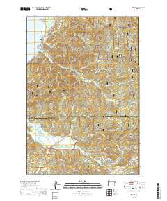
2020 Map of Neskowin
USGS Topo · Published 2020About this map
The coastal hamlet of Neskowin sits along the northern edge of this survey, where the Pacific Ocean meets Kiwanda Beach and the iconic Proposal Rock. The landscape is defined by its significant conservation areas, including the Nestucca Bay National Wildlife Refuge and the southern reaches of the Siuslaw National Forest. Inland, the terrain rises sharply toward Neskowin Ridge and Green Point, separated by numerous drainages such as Slick Rock Creek and the winding Salmon River. To the south, the expansion of Lincoln City and the community of Neotsu near the county line indicate the modern residential development of the Oregon coast. The Oregon Coast Highway serves as the primary artery connecting these shoreline settlements to inland communities like Otis and Rose Lodge, illustrating the region's dependence on this single transportation corridor through the timbered hills.
Find a feature on this map
89 named features on this map. Tap any name to fly to it.
Don’t see what you’re looking for? This feature index may not catch every label — zoom into the map to look around manually.
Map Details
Editions of this 2020 Neskowin Map
This is the sole edition of this map. No revisions or reprints were ever made.
Other maps of this area

1941 · Nestucca Bay
USGS Topo · 1:62,500

1941 · Cape Foulweather
USGS Topo · 1:62,500

1942 · Euchre Mtn
USGS Topo · 1:62,500

1942 · Nestucca Bay
USGS Topo · 1:62,500

1943 · Euchre Mtn
USGS Topo · 1:62,500

1944 · Cape Foulweather
USGS Topo · 1:62,500

1948 · Vancouver
USGS Topo · 1:250,000

1950 · Vancouver
USGS Topo · 1:250,000

1950 · Vancouver
USGS Topo · 1:250,000

1953 · Salem
USGS Topo · 1:250,000