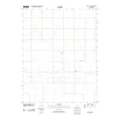
2009 Map of Ness City SE
USGS Topo · Published 2009About this map
The Pawnee River meanders across this rural landscape in Ness County, defining the local geography as it flows through the small settlement of Riverside. This 2009 survey highlights the intersection of agricultural grid-lines and the natural hydrology of the High Plains, where the river and Sand Creek cut through the sections of the Kansas prairie. Local industry and ancestry are represented by the Riverside Oil Field and the Riverside Cemetery, which stand as markers of the community's economic and familial history. A network of rural section roads, such as E 70 Rd and the more rugged S V Rd 4WD, provides a detailed view of the infrastructure supporting this remote part of the state, tracing the paths that connect isolated farmsteads and local landmarks.
Find a feature on this map
11 named features on this map. Tap any name to fly to it.
Don’t see what you’re looking for? This feature index may not catch every label — zoom into the map to look around manually.
Map Details
Editions of this 2009 Ness City SE Map
This is the sole edition of this map. No revisions or reprints were ever made.
Other maps of this area

1892 · Ness
USGS Topo · 1:125,000

1894 · Ness
USGS Topo · 1:125,000

1955 · Great Bend
USGS Topo · 1:250,000

1957 · Great Bend
USGS Topo · 1:250,000

1958 · Great Bend
USGS Topo · 1:250,000

1966 · Ness City
USGS Topo · 1:24,000

1966 · Ness City NE
USGS Topo · 1:24,000
1966 · Bazine
USGS Topo · 1:24,000

1970 · Hanston NW
USGS Topo · 1:24,000

1970 · Jetmore NE
USGS Topo · 1:24,000