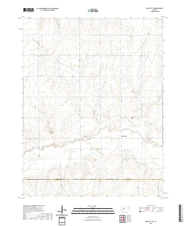
2022 Map of Ness City SE
USGS Topo · Published 2022About this map
The Pawnee River meanders across this rural Kansas landscape, marking a distinct geographical boundary near the settlement of Riverside. This 2022 survey captures a transition point on the High Plains where the grid of sectional roads, such as 30 RD and V Rd, meets the natural hydrology of the river basin. The map area straddles the border between Ness Co and Hodgeman Co, providing a clear view of the township and range system that organized this agricultural territory. Local history is anchored by the Riverside Cem, situated just north of the river, serving as a primary landmark for the surrounding community. The sparse distribution of named features reflects the open, prairie character of western Kansas, where life and travel are dictated by the straight lines of county roads and the winding path of the river.
Find a feature on this map
26 named features on this map. Tap any name to fly to it.
Don’t see what you’re looking for? This feature index may not catch every label — zoom into the map to look around manually.
Map Details
Editions of this 2022 Ness City SE Map
This is the sole edition of this map. No revisions or reprints were ever made.
Other maps of this area

1892 · Ness
USGS Topo · 1:125,000

1894 · Ness
USGS Topo · 1:125,000

1955 · Great Bend
USGS Topo · 1:250,000

1957 · Great Bend
USGS Topo · 1:250,000

1958 · Great Bend
USGS Topo · 1:250,000

1966 · Ness City
USGS Topo · 1:24,000

1966 · Ness City NE
USGS Topo · 1:24,000
1966 · Bazine
USGS Topo · 1:24,000

1970 · Hanston NW
USGS Topo · 1:24,000

1970 · Jetmore NE
USGS Topo · 1:24,000