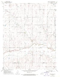
1970 Map of Ness City SE
USGS Topo · Published 1972About this map
The Pawnee River meanders through the central plains of western Kansas in this 1970 survey, carving a distinct valley across the Ness Co Hodgeman Co line. The landscape reflects a mix of traditional agriculture and the emergence of the energy industry, most notably marked by the extensive Riverside Oil Field in the center of the map. For local historians and genealogists, the small settlement of Riverside and the nearby Riverside Cem serve as key landmarks for tracing family roots in the area. The terrain transitions from the high plains of Franklin and Highpoint down toward the southern drainage of Marena Creek in the Marena district. Scattered across the southern portion are several Sandpits, indicating local resource extraction alongside the oil operations that define the mid-century economy of this region.
Find a feature on this map
11 named features on this map. Tap any name to fly to it.
Don’t see what you’re looking for? This feature index may not catch every label — zoom into the map to look around manually.
Map Details
Editions of this 1970 Ness City SE Map
This is the sole edition of this map. No revisions or reprints were ever made.
Other maps of this area

1892 · Ness
USGS Topo · 1:125,000

1894 · Ness
USGS Topo · 1:125,000

1955 · Great Bend
USGS Topo · 1:250,000

1957 · Great Bend
USGS Topo · 1:250,000

1958 · Great Bend
USGS Topo · 1:250,000

1966 · Ness City
USGS Topo · 1:24,000

1966 · Ness City NE
USGS Topo · 1:24,000
1966 · Bazine
USGS Topo · 1:24,000

1970 · Hanston NW
USGS Topo · 1:24,000

1970 · Jetmore NE
USGS Topo · 1:24,000