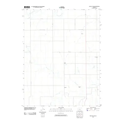
2009 Map of Ness City SW
USGS Topo · Published 2009About this map
Harold sits at the intersection of a vast grid of county roads in this portion of Ness County, where the high plains are carved by seasonal watercourses. The landscape is defined by the drainage patterns of Guzzlers Gulch and the Pawnee River in the south, while the South Fork Walnut Creek skims the northern boundary. This 2009 survey reveals a rural economy balancing traditional agriculture with energy extraction, evidenced by the Petersilie Oil Field. For local historians and genealogists, the map preserves the locations of significant community sites including Kunze Cemetery and Dundee Valley Cemetery, which serve as quiet landmarks amidst the expansive section-line road network such as Co RD 533 and W 60 RD & CTY RD 528.
Find a feature on this map
17 named features on this map. Tap any name to fly to it.
Don’t see what you’re looking for? This feature index may not catch every label — zoom into the map to look around manually.
Map Details
Editions of this 2009 Ness City SW Map
This is the sole edition of this map. No revisions or reprints were ever made.
Other maps of this area

1892 · Ness
USGS Topo · 1:125,000

1894 · Ness
USGS Topo · 1:125,000

1955 · Great Bend
USGS Topo · 1:250,000

1955 · Scott City
USGS Topo · 1:250,000

1957 · Great Bend
USGS Topo · 1:250,000

1958 · Great Bend
USGS Topo · 1:250,000

1958 · Scott City
USGS Topo · 1:250,000

1966 · Ness City
USGS Topo · 1:24,000

1966 · Ness City NE
USGS Topo · 1:24,000

1966 · Laird
USGS Topo · 1:24,000